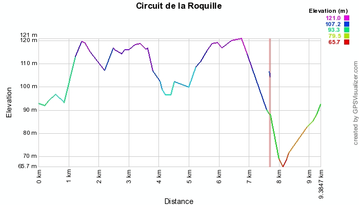
Distance: 9 km
walk
Duration: 2h
Difficulty : Average
Departure: LA ROQUILLE
THE ROCKET
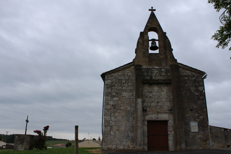
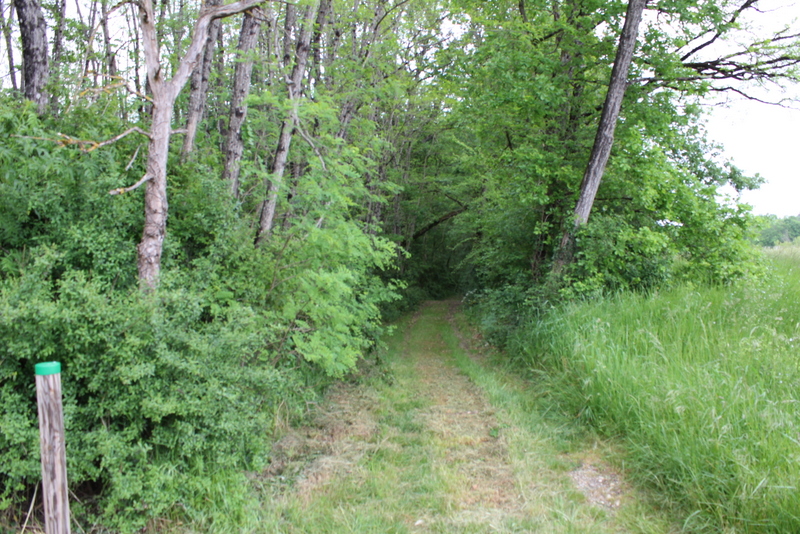
You will be able to discover the church from 1730 right from the start. You will enjoy hiking through woods, vineyards and country roads. Do not miss the beautiful view over the valley at the Terrier mill. Returning to the Roquille, in Galineaux-Est, you will see the XNUMXth century washhouse and fountain, whose well has been preserved since Gallo-Roman times. Also worth seeing: the XNUMXth century town hall, installed in the Old Temple of the village, has a pretty entrance porch and six bays inspired by Romanesque art.
Your itinerary
1
Departure.
The departure is from the school of La Roquille. Head towards the church and go past it. Then turn left and go straight for 200m.
2
Place called La Croix.
At a place called La Croix, turn right and go straight past the cemetery. You walk along the vines and arrive at the hamlet of Jeanlins. After 500m, you arrive at a place called Valfontaine.
3
Place known as Valfontaine.
At the crossroads, turn left and go 300m. You pass the exit sign for the village of La Roquille. You walk past woods and vines.
4
D708.
You cross the D708 and go straight ahead. Then you go deeper into the woods and pass next to a palombière.
5
Place called Chataignier.
After 300m, you arrive near a water pump at a place called Le Chataignier then you follow the beacon straight ahead. You continue in the woods. At the top of the hill, you are now in the vineyards.
6
Common limit of Margueron.
At the beacon gate, you turn right through the vineyards and walk along the boundary with the town of Margueron. After 200m, at the beacon continue straight.
7
Asphalt road.
You find the asphalt road again and at the beacon you go straight ahead.
8
End of the commune of La Roquille and Margueron.
Then at the second beacon, you turn right continuing to take the paved road. You are surrounded by vineyards. You are at the end of the town of La Roquille and at the beginning of the town of Margueron.
9
Place called Bel Air.
At the beacon, turn right and continue on the paved road. You are at a place called Bel Air. At the beacon, continue straight for 200m towards the D708.
10
Cross the D708.
At the stop sign, cross the D708 and at the beacon continue on the dirt road along the vineyards. You are between woods and fields. At the beacon, continue straight on in the middle of the vines.
11
Place called Baillou.
At the beacon, you go straight and cross the paved road. Then take the dirt road on the edge of the wood. You have a nice panorama of the valley on both sides. You see a pond on your left and are surrounded by fields.
12
Wood.
You walk along the woods and at the beacon, you turn left, taking the tarmac road and crossing the woods. You pass near a palombière.
13
Mill of the burrow.
At the beacon, turn right on the dirt road. You are between woods and vines. You arrive at the mill of the burrow from where you can contemplate a superb panorama on the valley.
14
Head to a place called Gillet.
At the beacon, you leave the dirt road and take the tarmac road on your right towards the place called Gillet. At the second marker, you enter the woods, staying on the tarmac road.
15
Intersection place called Gillet.
At the intersection at a place called Gillet, take the forest path opposite. After 300m, you will find a beacon on the right and you will continue straight. After 100m, you enter the woods. You descend a slope then follow a clearing to end up crossing a bridge (spanning the Sandaux stream) on your right. Then continue straight to cross a bridge on your left.
16
D141.
At the intersection at the beacon, turn right onto the D141. Continue straight on the road until the intersection with the D708.
17
Return.
You join the D708 and turn right. Continue for 50m, then turn right at a place called Bois d'Isaac to reach your starting point.