ROOMS
Nature walk in the footsteps of “Salomacum”, the salt market.
Your itinerary
1
Val de l'Eyre Tourist Office
Departure from the Tourist Office, parking area and assembly point.

2
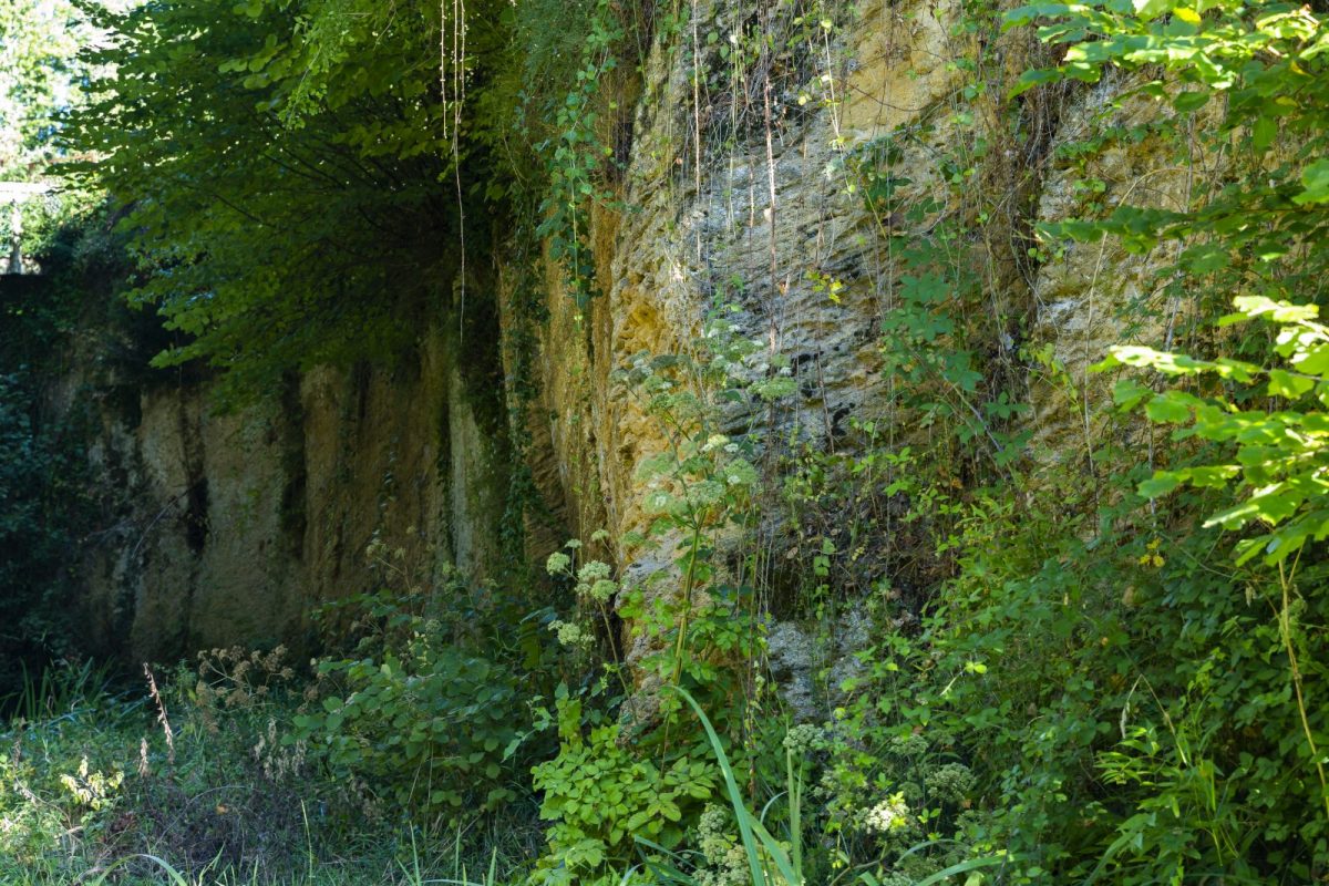
The Faluns, archaeological wall
The Faluns, archaeological wallFrom the end of the 12th century, in Salles, paleontologists and geologists analyzed and dated the many remains of marine organisms, very well preserved in the rock. They also named Sallomacian this period from the Miocene to the Tertiary era (18 million years). Scholars and individuals, for several decades, excavated and brought to light very rich collections of fossils. On the right bank of the Leyre, notice the stone cliff several meters high, the long streaks in the rock, the wall interspersed with sorts of vertical wells. As you approach, you will be able to observe the footprints of molluscs. These sediments, called faluns, are concretions of sand and shells formed in the Tertiary era. Indeed, the wider Bay of Biscay extends from Poitou to the bottom of Chalosse and Armagnac. These heaps of limestone deposits, in successive strata, will be shaped by the tides and currents, before the sea gradually recedes. The sands have covered these shell mounds but they outcrop at Salles where they will be used for local buildings. There were discovered many teeth of Megalodons, giant sharks that can measure XNUMXm.

3
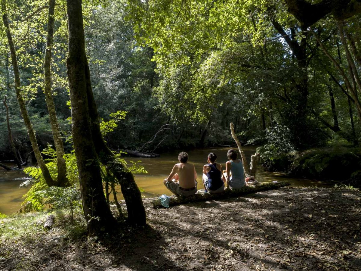
The Eyre
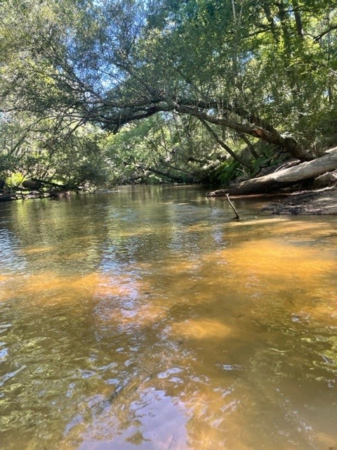
The river, the Leyre A real link between the Gascony forest and the sea, the Leyre stretches out over 135 km. Beneath its uniform aspect, the Leyre is in fact multiple. The Petite Leyre, calm, with clear water, and the Grande Leyre, impetuous, with dark water, meet at Moustey to give birth to the wider Eyre, which branches out into a generous delta in contact with the Basin. from Arcachon. Until the arrival of the first railway lines, the wood from the forests was transported by floating on the Leyre and it was impressive to see the rack maneuvering from its pole with astonishing skill this long train of wood up close. of 100 meters.
4
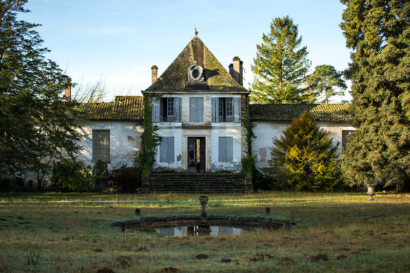
The castle of Salles
The castle of Salles This castle, which some writers have confused with Castéra, is about 2 km away from the latter, and stands on the right bank of the Leyre. Arnaud de Pontac, in the 3th century, had it built on the banks of the Leyre the castle replacing Castéra. The elegant charterhouse, built with stones from the nearby quarry, has a central body of 1563 bays, a monumental staircase and large cellars. After 1760, Jean de Pontac, lord of Salles, Belin and Béliet, abandoned the old castéra ruined and whose trace remains only in the name given to a street of the commune. He had another castle built on the banks of the Leyre. The castle was then occupied by the lords of Monferrand in 1780, of Pichard in 1800 and by the Count of Puységur around 1734. On the eve of the Revolution, the lord of the parish was Nicolas Pierre de Pichard, born in 1760, from a family of Bordeaux parliamentarians. He himself became a parliamentarian and general counsel before being mortar president of the parliament of Bordeaux in XNUMX.

5
The biodiversity of the Leyre Valley
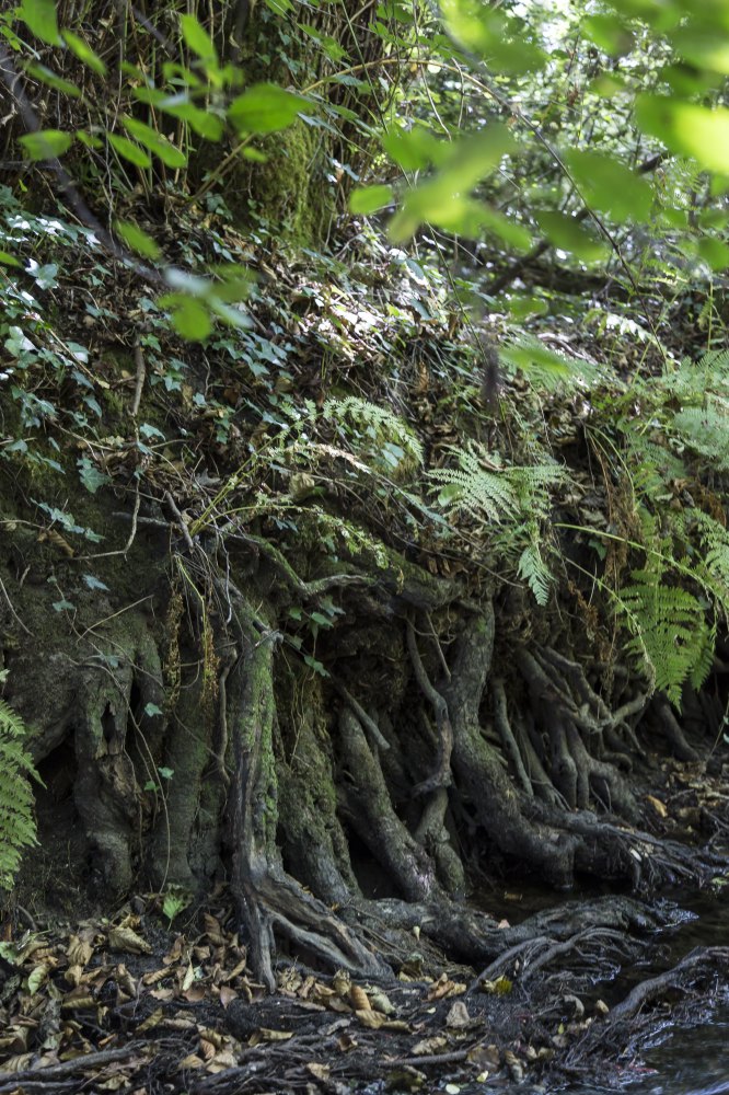
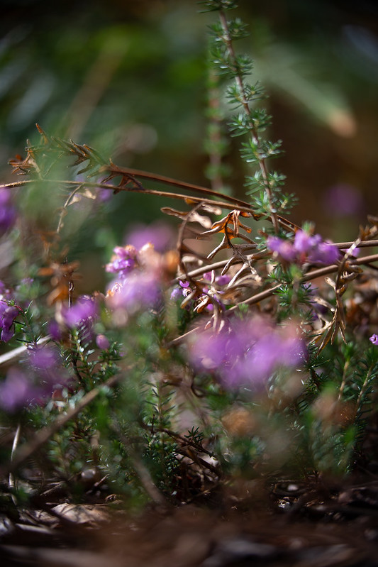
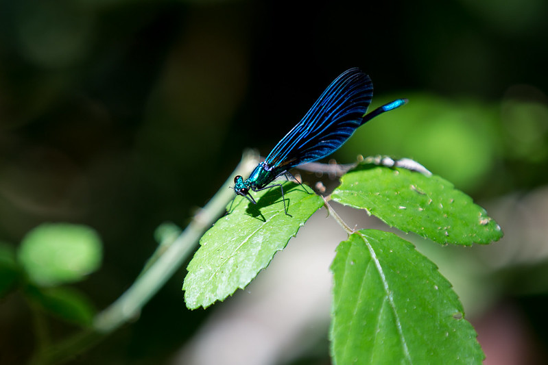
Gallery forest Until the 1960s, the Leyre was largely bordered by meadows. Abandoned for more modern agriculture, these have evolved into a deciduous forest, called gallery forest. This plant tunnel forms a transitional forest between the river on one side and the cultivated maritime pine forest or agricultural areas on the other. Narrow upstream due to the entrenchment of the river, it widens up to one kilometer in the middle part of the valley. Part of the life of the river, the forest dampens floods and limits the transport of suspended matter. It participates in maintaining the banks of the watercourse thanks to the root system of its vegetation. Plant species This forest consists mainly of oaks, alders, willows, etc. Its cool microclimate and its soft luminosity favor the appearance of a rich and often original flora composed of water lilies, water buttercups, or rarer species such as the royal fern or the round-leaved sundew.Animal species Since its appearance , this deciduous forest has also become a habitat for many species, some of which are endangered, such as the European otter, the European mink, the pond terrapin, the genet or bats, which find varied food and a corridor to move around. In the middle of the river, the water is clear and shallow and sand predominates. It is here that the flounder stays, discreet by its mimicry, and that the larvae of lampreys are born. On the edges, where the waters are more muddy, there are aquatic grass beds and intertwined tree branches, ideal hiding places for many species of fish, such as pike, gudgeon, dace, minnows or eels.
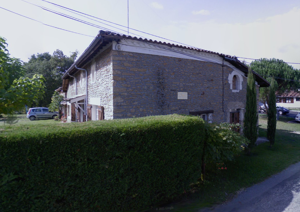
6
Beguey district
Former district of Salles which runs along the right bank of the Leyre.
Full screen Close
Departure ROOMS
Points of interest

Val de l'Eyre Tourist Office

The Faluns, archaeological wall

The Leyre, a magnificent calm, shady and wild river flowing over clear, amber waters

The castle of Salles

The biodiversity of the Leyre Valley

Former district of Salles which runs along the right bank of the Leyre.

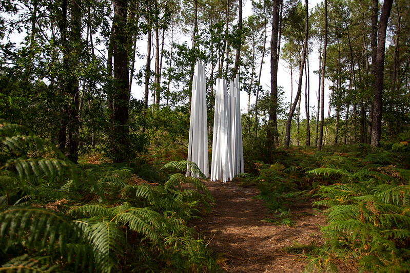
Three without a name, Sébastien Vonier, Salles 2014