Distance: 19 km
walk
Duration: 7h
Difficulty : Difficult
Departure: SAINT-SEURIN-DE-CADOURNE
Around water (canal, stream, lake, marsh, ...)
Campaigns
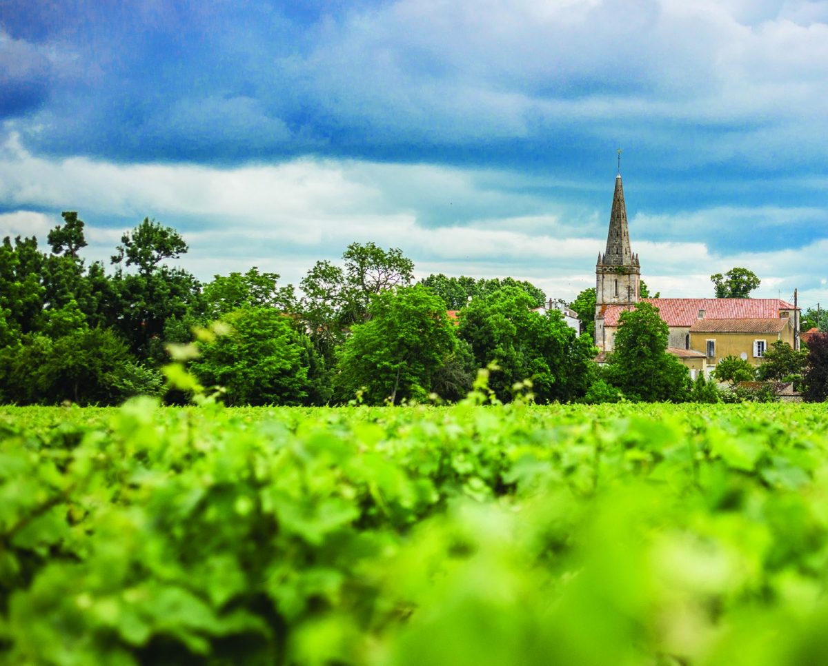
SAINT-SEURIN-DE-CADOURNE
Along the Vertheuil marsh, where you can see in the distance the castle and the roofs of the abbey of Vertheuil, the walker reaches the village of Saint-Seurin-de-Cadourne, surrounded by its wine châteaux.
From there, the path through the vines offers striking views over the estuary and joins the palus, where a path on a dike punctuated with squares leads you to the port of the Maréchale.
Heritage, landscapes, nature, vineyards are on the program!
From there, the path through the vines offers striking views over the estuary and joins the palus, where a path on a dike punctuated with squares leads you to the port of the Maréchale.
Heritage, landscapes, nature, vineyards are on the program!
Your itinerary
1
Port of the Maréchale
Admirably positioned in a curve of the estuary, surrounded by a beautiful reedbed, this small port welcomes pleasure boats and a few fishing boats. Local fishermen sell prawns, eels and mules here. The place, with its old cobblestone pier, is imbued with calm and serenity. A stele erected in honor of those lost at sea reminds us that the profession of sailor is risky.
2
The old marshes
The hiking loop crosses the marshes, developed by man and whose land is now transformed into meadows for harvesting hay, where herds of cattle graze. These wetlands, on the other hand, are a privileged environment for all species of birds: storks, egrets and gray herons… but also for mammals, amphibians, reptiles and insects.
3
Colombier of Verdus castle
Circular in shape, this feudal dovecote has 1830 nesting boxes on the internal wall of the cylindrical tower. These correspond to small cubicles built in freestone or pottery which are embedded in the wall. It is estimated that 8000 to 10 pigeons frequent this loft per year. The dung of the pigeons - the columbine - is an excellent fertilizer. The pigeons feed on the insects in the vines and of course figure in the menus served at the table of the lords.
4
Château Bardis and Château Verdus
The castle of Verdus comes from the old feudal domain of Bardis, which was divided at the end of the 1840th century into two seigneuries, one of which is called “de Verdus”. In the 1911th century, the castle belonged to Gabriel de Trevey de Charmail, commander of the Medoc Dragons and officer of the Lamarque harbor master's office. The Verdus and Bardis castles were reunited in 1929, then separated and united again in 1670. In XNUMX, part of the Verdus castle was demolished. There remains today a defense tower and a main building. The current building, perpendicular to the old castle, dates from around XNUMX.
5
Brion Archaeological Site
It is located 3 km east of the village of Saint-Germain-d'Esteuil, on a limestone plateau stretched from south to north. Oval-shaped, this site dominates a vast marshy expanse, the Reysson marsh, partly reclaimed in the 10th century. The ruins stretching from south (theater) to north (temple), following the shape of the plateau, are those of 'a small Gallo-Roman agglomeration which covered about 5,5 hectares. It developed between the middle of the XNUMXst century and the beginning of the XNUMXrd century AD, succeeding an agglomeration of the Iron Ages whose remains have been unearthed not far from the temple. This agglomeration is probably that of Noviomagus, which was with Bordeaux (Burdigala) one of the two cities of Bituriges Vivisques (the city of which Bordeaux was the capital) according to the geographer Ptolemy, who lived in the XNUMXnd century AD The site being located at XNUMX km from the Gironde estuary, the question arises whether there was a port there connected by a channel to the Gironde. It is probable for the Bronze Age, but the extension of the marsh did not allow any more communication with the ocean in the first centuries of our era.
6
The megalithic monument of Barbehère
500m west of the Barbehère farm, at a place called Bois des Haures, in the town of Saint-Germain-d'Esteuil, is a megalithic monument (built in large stones), the best preserved of the Médoc, which has been the subject of a recent restoration and refurbishment for presentation to the public. know this Neolithic monument, erected in a relatively populated area at that time, as confirmed by the discovery of several Neolithic settlements, the Peuilh in Vertheuil, the Moats in Saint-Seurin-de-Cadourne, the Hourqueyre in Saint-Yzans ... which can be associated with the monument. Built on a limestone base, the monument is a dolmen surrounded by a tumulus, an eccentric ovoid-shaped mound made of clay soil surrounded by a stone facing. The uprights of the dolmen are made of large flat stones erected vertically. The rectangular burial chamber delimited by an apse, side slabs and an open entrance between two transverse slabs. The dolmen no longer has a cover. It is very likely that it was covered with logs; the stones used for the construction seem to have been quarried from a nearby quarry on the Lalo mound. The megalith of Barbehère is classified in the “alleys of Aquitaine”, which stand out from the classic covered alleys, with the particularity of having a decreasing height of the slabs from the bedside to the entrance. The monument would have been erected in the Middle Neolithic (circa 1987 BC). This important collective burial place contained around 1992 skeletons. The excavated archaeological material is mainly represented by flint objects (sharp frames, arrowheads with peduncles and fins, drills, scrapers, hammers, polished axes of the Middle Neolithic and Late Neolithic. Ceramics, is mainly represented by the Peu-Richardien (Late Neolithic) The elements of adornment discovered by their importance and their diversity belong to the Neolithic and Chalcolithic (campaniform culture in the Copper Age) stone and bone pearls, gold, shell pendants ... The monument is frequented during Protohistory, as evidenced by pastillage ceramics from the Middle Bronze Age, a cremation burial from the 5000st Iron Age and ceramic fragments from the Gallo-Roman period.
7
Boyentran Dovecote
Near the hamlet of Boyentran (Saint-Germain-d'Esteuil), route de Marque, in a meadow, is a small circular construction covered with a stone dome, which ends in a curious summit made of assembled stones. Several openings are made in the cylindrical tower including a flight hole. A drip edge at the base of the cap suggests the initial vocation of this small monument, namely a dovecote.
8
Bollée wind turbine at the Barbehère farm
The Bollée wind turbine, invented by Ernest-Sylvain Bollée (1814-1891), hydraulic engineer, produced in France from 1872 to 1933, in around 350 units, was used for pumping water. 'Esteuil) was built in 1883. Although no longer in working order, it is part of the series of ten Bollée wind turbines installed in Gironde, between 1875 and 1898. Two other wind turbines still stand at the Domaine de Baritault in Carignan and the Château Cheval Blanc estate in Saint-Germain-de-Grave. Wealthy owners were the first buyers of this machine. They are looking for the modern comfort provided by running water, which is also used to decorate the gardens animated by ponds and water jets. The wind turbine also contributes to supplying the farms with water, which is the case in Barbehère. This hydraulic wind machine is composed of a cast iron column, held by 6 iron stays, supporting the entire wind motor composed of 'a fixed steering wheel (the stator) carrying curved vanes intended to direct the wind towards the vanes of a mobile wheel (the rotor). A small paddle wheel (butterfly) allows the assembly to rotate, depending on the direction of the wind. The water is raised by a pump actuated by a shaft rotated by the rotor. The wind turbine is built over a deep well. A spiral staircase with cast iron steps provides access to the platform under the turbine. Rare today, these monuments deserve attention and protection. The Bollée wind turbine at the Beauval estate in Bassens (Gironde), restored and in perfect working order, can once again fill the washhouse basin, located next to it and help water the Beauval park.
9
The ruins of the former L'isle abbey in Ordonnac
From the path of the loop, one can see, to the east of the current village of Ordonnac, the ruins of the old abbey, located on a high site, in a landscape of old marshes. Abandoned for three centuries (it has been in ruins since 1708), only a few romantic walls remain: a wall pierced with a large Gothic bay at the apse, a fortified door, a protective ditch and two medium-sized constructions. device, which show traces of twin Gothic windows. In the embankment remains a round construction, which has lost its cover, which is none other than a large dovecote. A rural path goes around the abbey. A farm has been set up on the site.Remember that in the Middle Ages, two establishments of Augustunian canons established centers of religious life on the Médoc peninsula: Saint-Pierre de Vertheuil and Saint-Pierre de l'Isle . The latter was created in 1130 by Bishop Geoffroi du Louroux, then master of Sablonceaux in Charente Maritime, on land donated by the lord of the place, Eyquem-Guillaume de Lesparre. This same creation was approved, on the same date, by the Archbishop of Bordeaux Arnaud-Géraud de Cabanac.
10
End of the course
Return to the port of the Maréchale.
Points of interest
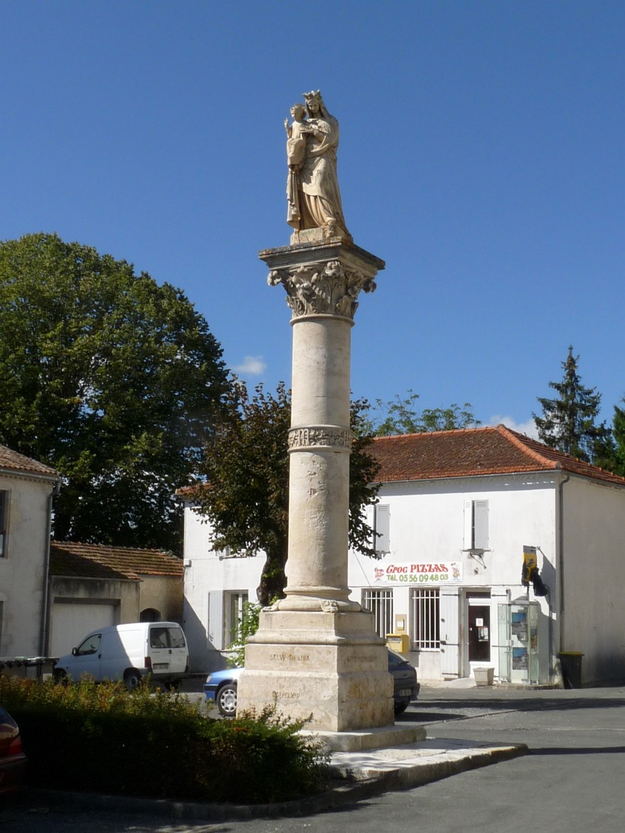
The Column of the Virgin, village of Saint-Germain d'Esteuil Listed in the Supplementary Inventory of
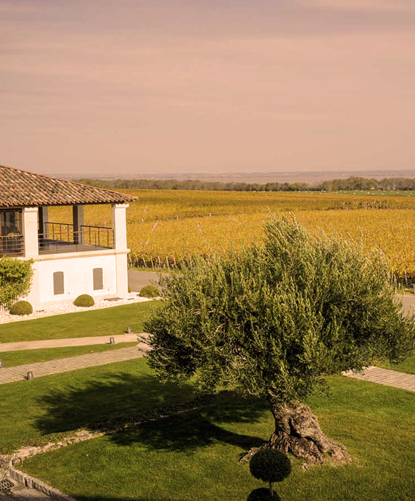
Chateau Sociando-Mallet